Every well, canal and acre in one clear record.

HydroData and ProducerConnect help water districts, canal companies and municipalities track supply, measure use and stay connected with their water users, on the web and on iOS and Android.

  • 20+water organizations
  • 4 statesand growing
  • iOS & Androidapps for staff and producers
  • Offlinedata collection in the field

One system, three ways in.

HydroData is the core. ProducerConnect opens it to your water users. hydrodata.ai brings AI to the same records.

  • HydroData on the web: a map of tracts, wells and meters

    The system of record for district staff. Map and manage tracts, wells, meters, canals and allocations, then report on usage. Field staff collect readings in the mobile app, even without service.

    hydrodata.app →
  • ProducerConnect on the web: a producer's tracts and usage

    An add-on to HydroData for your water users. Producers see their tracts and usage, submit meter reads and crop reports, and get notices from you, from a browser or their phone.

    producerconnect.com →
  • hydrodata.ai MCP live

    Which wells on tract 14-0221 are near their allocation?
    search_structures → 3 wells
    get_usage 2026
    W-1182  11.9 of 14.0 in  85%
    W-1190  12.6 of 14.0 in  90%

    Hydro MCP lets assistants like Claude read your records with your permissions. Meter Vision, Nutrient & Water Management and Crop Solver are in development.

    hydrodata.ai →

HydroData and ProducerConnect on iOS and Android.

District staff and producers work from the same record in the office, in the field and on their phones.

For field staff

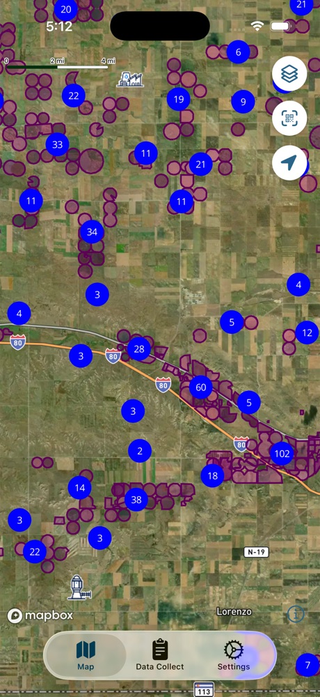
HydroData mobile

Read meters, check wells and update locations on site. Data saves on the device and syncs when you're back in service.

  • Meter reads and water levels
  • Works without cell service
  • iOS and Android
HydroData mobile app showing a map of tracts and wells
For producers

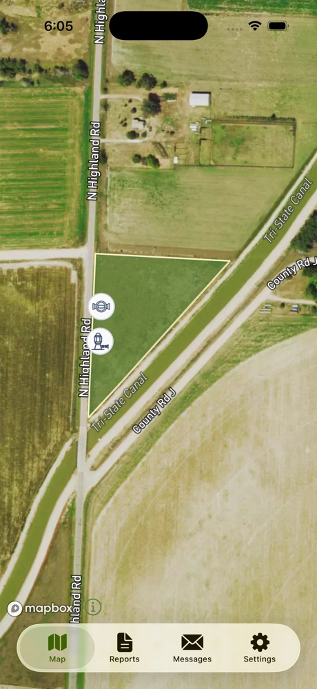
ProducerConnect mobile

Producers check usage against their allocation, submit meter reads and reports, and get notices from the district.

  • Tracts and usage on a map
  • Meter reads, crop reports, soil tests
  • iOS and Android
ProducerConnect mobile app showing a producer's tract

Follow water from the source to the crop.

Canal deliveries, well pumping and rainfall come together at the field. HydroData keeps the canals, wells, meters and tracts behind those numbers in one record.

2026 season · 512 ac

Canal deliveries
180 AF
Well pumping
320 AF
Precipitation
140 AF
Applied vs. allocation
500 / 560 AF
89% of allocation used · illustrative numbers

Built for the organizations that manage water.

  • Groundwater districts

    Wells, flowmeters, certified acres, allocations and annual reporting.

  • Irrigation districts

    Diversions, canals, turnouts and weirs, linked to the tracts and meters they serve.

  • Canal & ditch companies

    Canals and turnouts mapped alongside the tracts, owners and operators on each.

  • Municipalities

    Municipal wells, meters and usage alongside agricultural water.

Serving water organizations across the U.S., currently in Colorado, Mississippi, Nebraska and Wyoming, and growing.

See HydroData with your district's data.

We'll walk through your wells, canals, reports and apps with you.

Contact us →